Villages of Alston Area Plan
City of Cary
Location
Cary, North Carolina
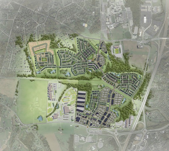
The Villages of Alston began as a small area plan for Cary’s Northwest Area, a 1,000-acre suburban area that, at the time of the plan, was mostly undeveloped farmland, wooded natural areas, stream valleys, and rural properties. The study area includes some established residential development, a church, a high school, and older post war homes. The study area is surrounded by rural, large lot homes and a few small industrial buildings. As a result of the widening of Route 55, the Northwest Area was designated a priority growth area. Design Collective was engaged by the Town of Cary to prepare the Northwest Area Plan.
The master plan for the Villages of Alston was designed during a week-long public planning and design charrette for the City of Cary, NC as part of their Comprehensive Plan process. Charrette participants included residents from nearby neighborhoods that would be impacted and who, initially, were opposed to development. By listening and educating participants the team was able to address concerns and build consensus. Strategies included interactive work sessions, evaluation of case studies, and selection and ranking of precedent images and photographs of best practices. The team shared examples of known local and historic towns that were walkable, attractive and well liked, and included mixed-use buildings, a mix of housing types, great architecture, and complete streets and multimodal transportation strategies that safely accommodated cars, pedestrians and cyclists. This collective education regarding forward-thinking community planning and New Urbanism principles, including the adoption of a form-based code, helped build support for development, rezoning, higher densities, mixed-use, rental housing, mixed-income housing, and other considerations. The charrette process, too, helped uncover the history of a small rural street and community called Alston – hence, the name Villages of Alston. Today, the area is referred to as the Alston Regional Activity Center.
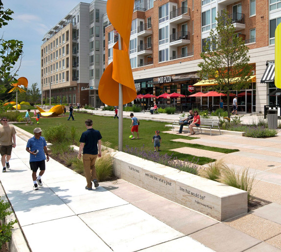
The master plan suggests a new urban fabric, a network of streets, neighborhood nodes and centers, and an open space network that links natural areas, parks, schools, and centers. The Form-Based Code requires buildings to face the street, parking in the rear, and first floor retail on primary streets, among other items. The master plan and Code were formally adopted and include a unique development approval process to ensure planning principles and design standards are adhered to. The plan and Code have guided the construction of roads, infrastructure, the Nancy Branch Greenway, the preservation of natural areas, and several new developments, including Parkside Town Commons, the Abberly, Evans Farms, and Alston Yards.