
Downtown Columbia Masterplan & Charrette
Howard County Planning Department
Columbia, Maryland is one of the country’s first planned communities, envisioned by Jim Rouse in the 1960’s as a “new city” that placed human values, diversity, racial and religious integration, health and wellness, and sense of community as important goals.
The 14,000-acre development, today, includes several neighborhoods and neighborhood centers, schools, parks and trails, a variety of affordable and market-rate housing types, inter-faith churches and community-serving civic facilities, and numerous other amenities and uses typical of a thriving city with a population of 100,000 people. Columbia ranks among the highest jurisdictions in the country regarding advanced education, household incomes, home values, and public schools.
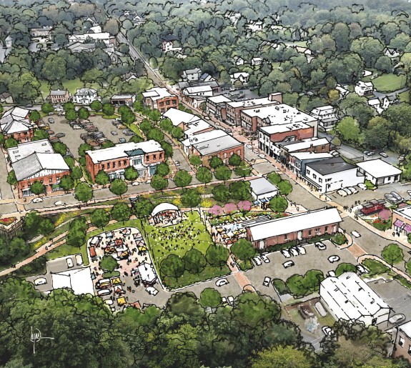
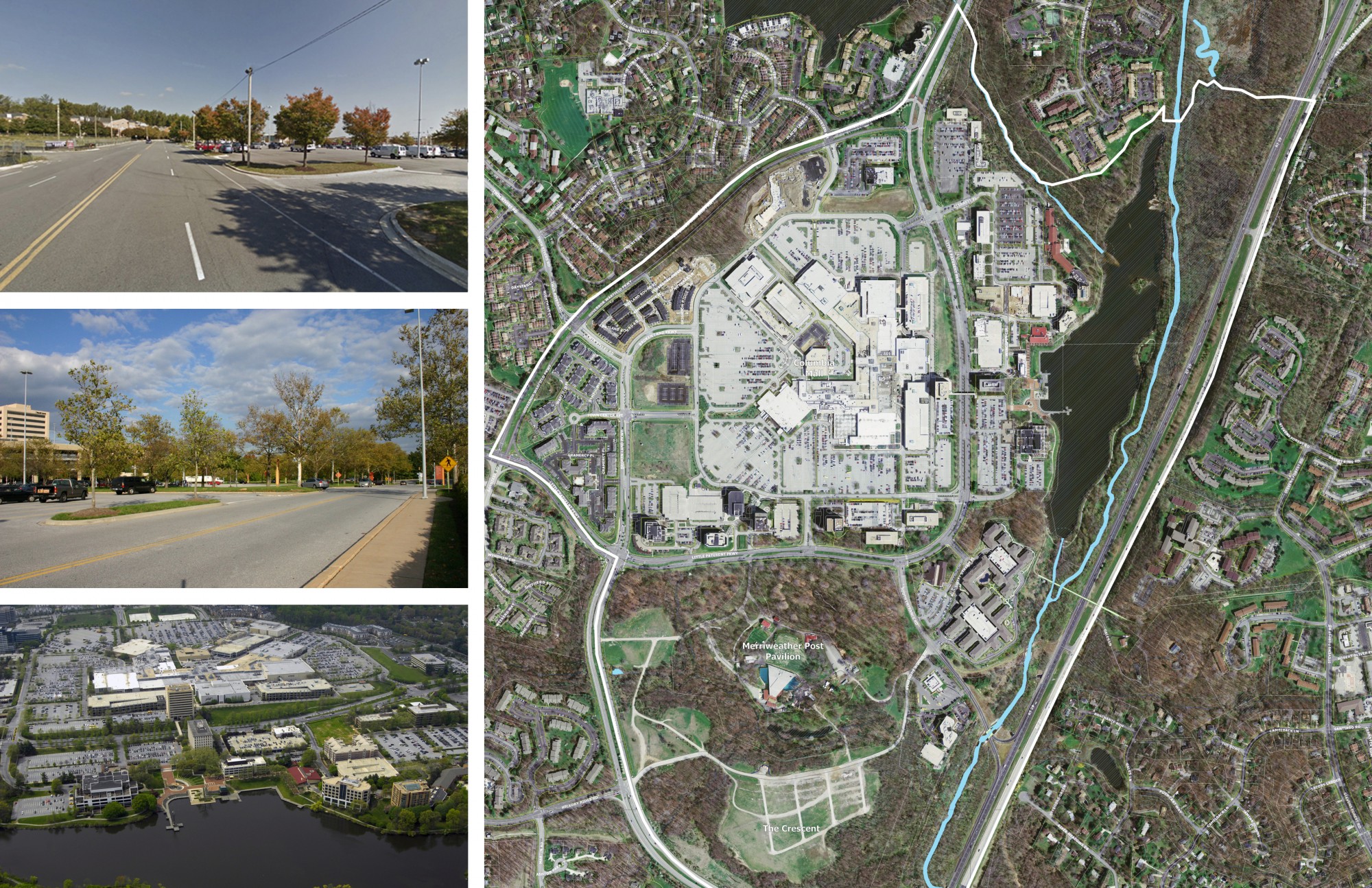
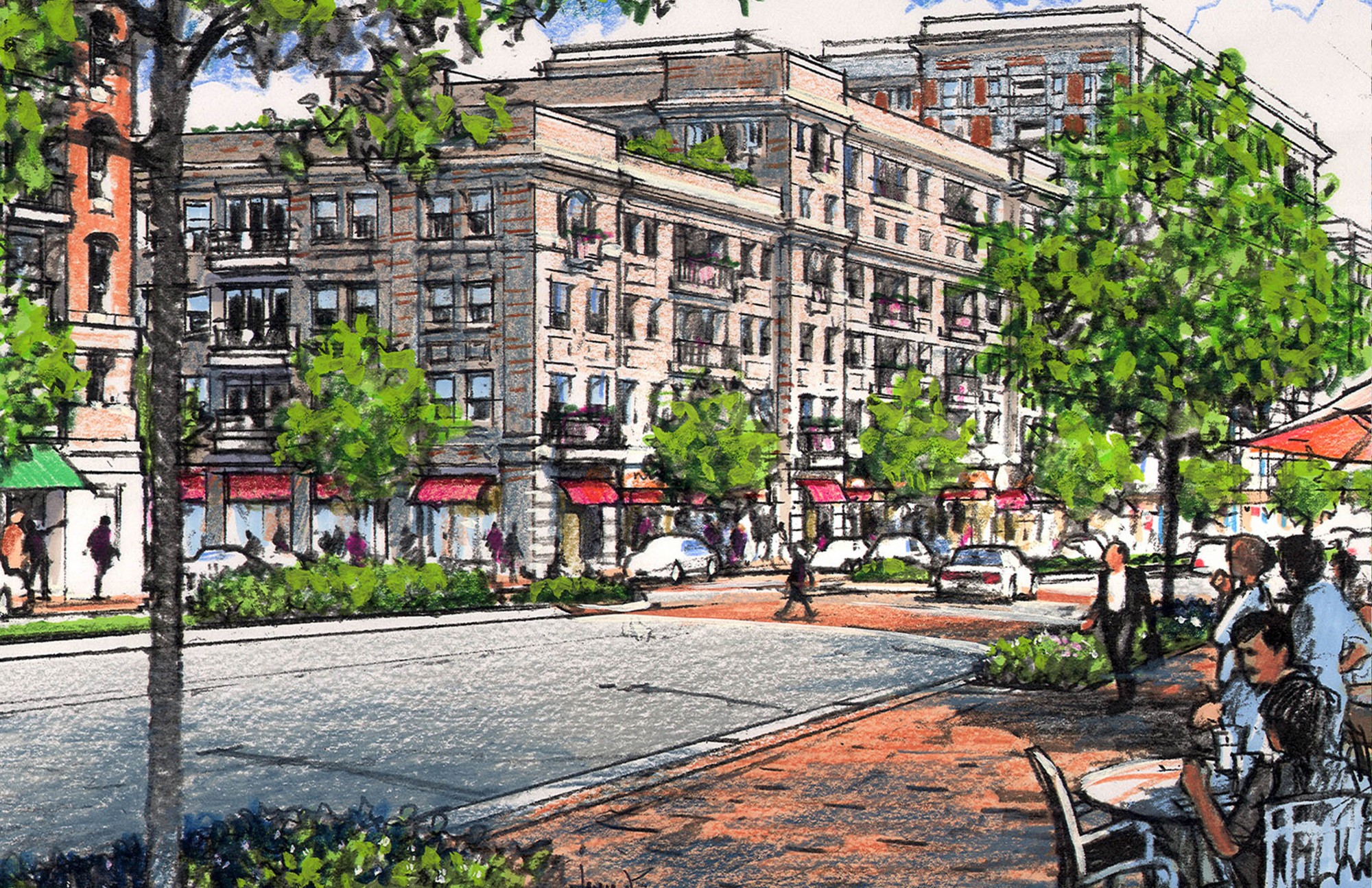
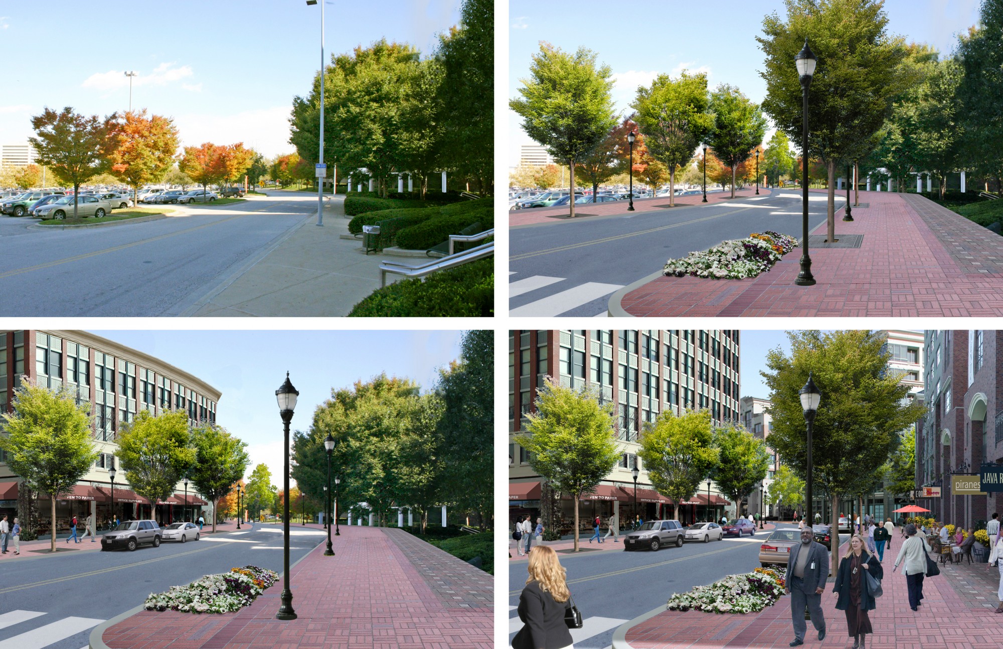
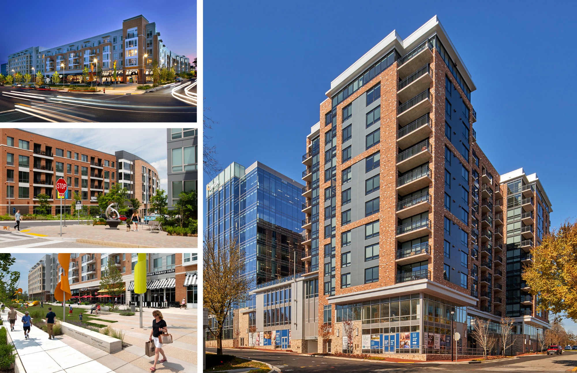
Rouse envisioned Columbia’s “Town Center” as a vibrant, dense, mixed-use, urban-like environment that would provide jobs, retail, and other destination uses for the new city. However, Columbia’s Town Center never materialized and, (at the time of this planning effort in 2005), remained a mostly auto-oriented destination, which includes a 1.4 million SF regional mall, several office buildings and pad-site restaurants along the mall ring road, and a beautifully landscaped waterfront park, amphitheater and promenade mostly supported by surface parking. Very little housing exists in the downtown. The auto-centric Town Center is mostly accessed by 2 wide, multi-lane parkways (Governor Warfield and Little Patuxent Parkways), includes very few connecting or network
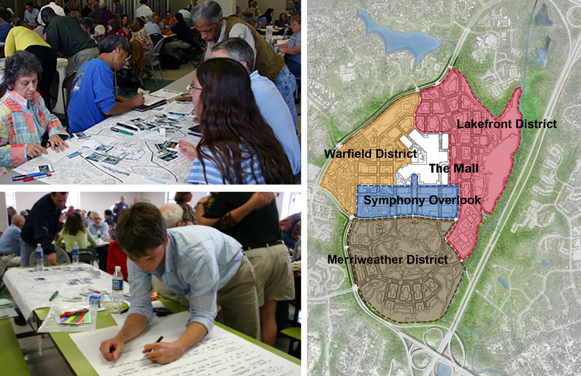
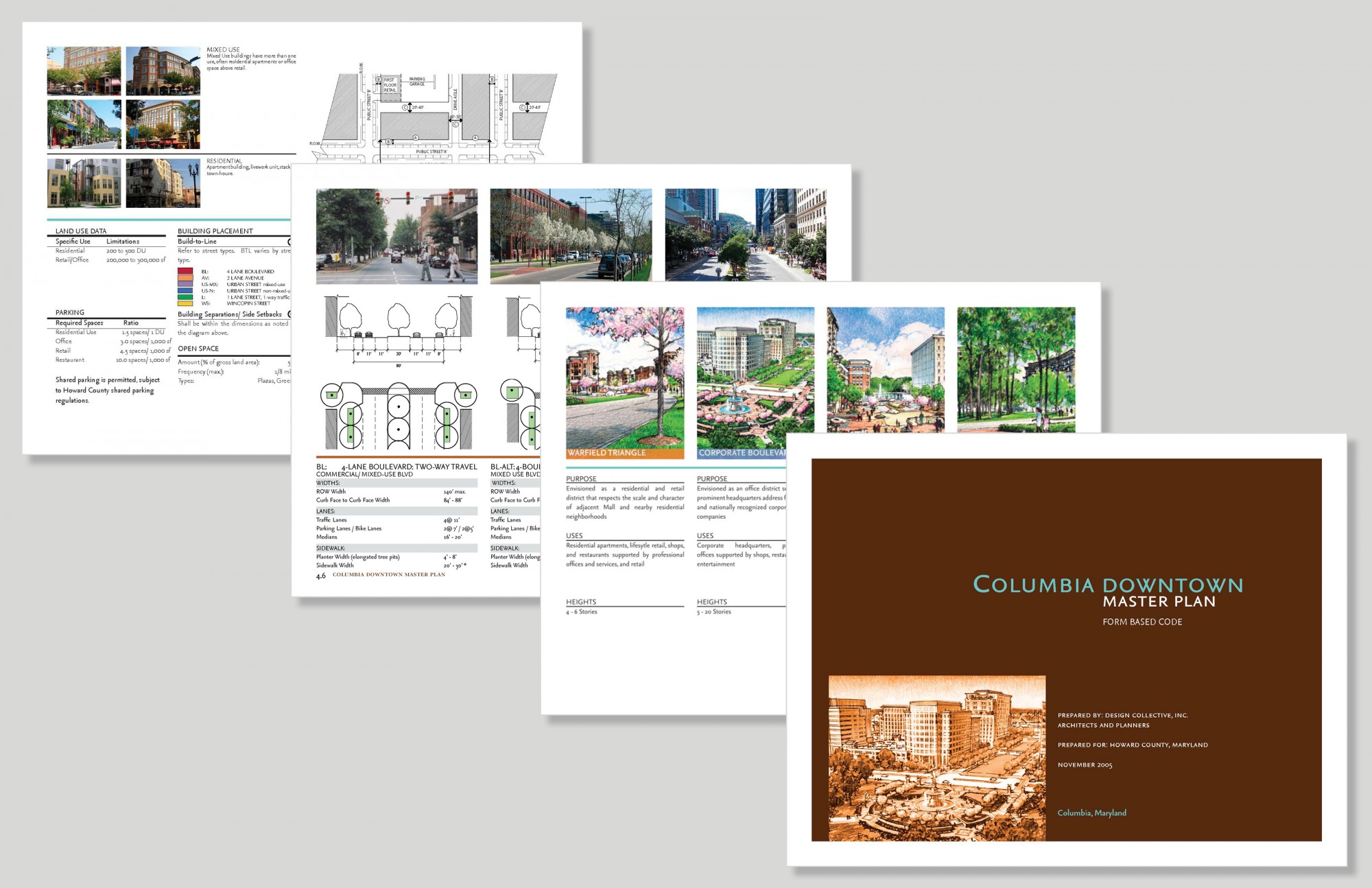
Design Collective was engaged by the Howard County Department of Planning in 2005 to establish a Small Area Plan and new 30-year vision for Columbia’s Town Center. The 18-month process included a week-long, 10-day, planning and design charrette with participation from over 1,000 residents, county stakeholders, property owners, developers and interest groups (public housing advocates, environmental groups, for example). The Plan was informed by a comprehensive market analysis, economic and fiscal impacts and benefits analyses, and traffic analyses. The Plan illustrates how the 500-acre Town Center could be transformed into a more dense, livable, and walkable, urban-like environment. The master plan received a 2006 CNU (Congress for New Urbanism) Charter Award.
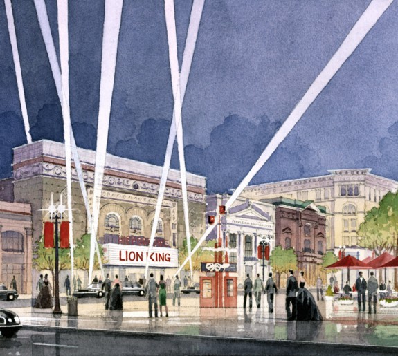
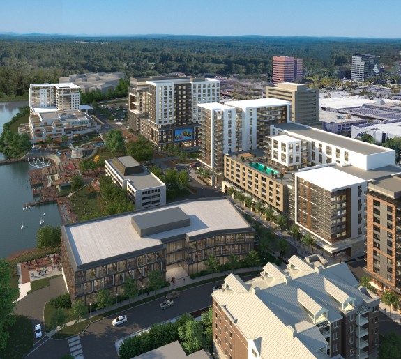
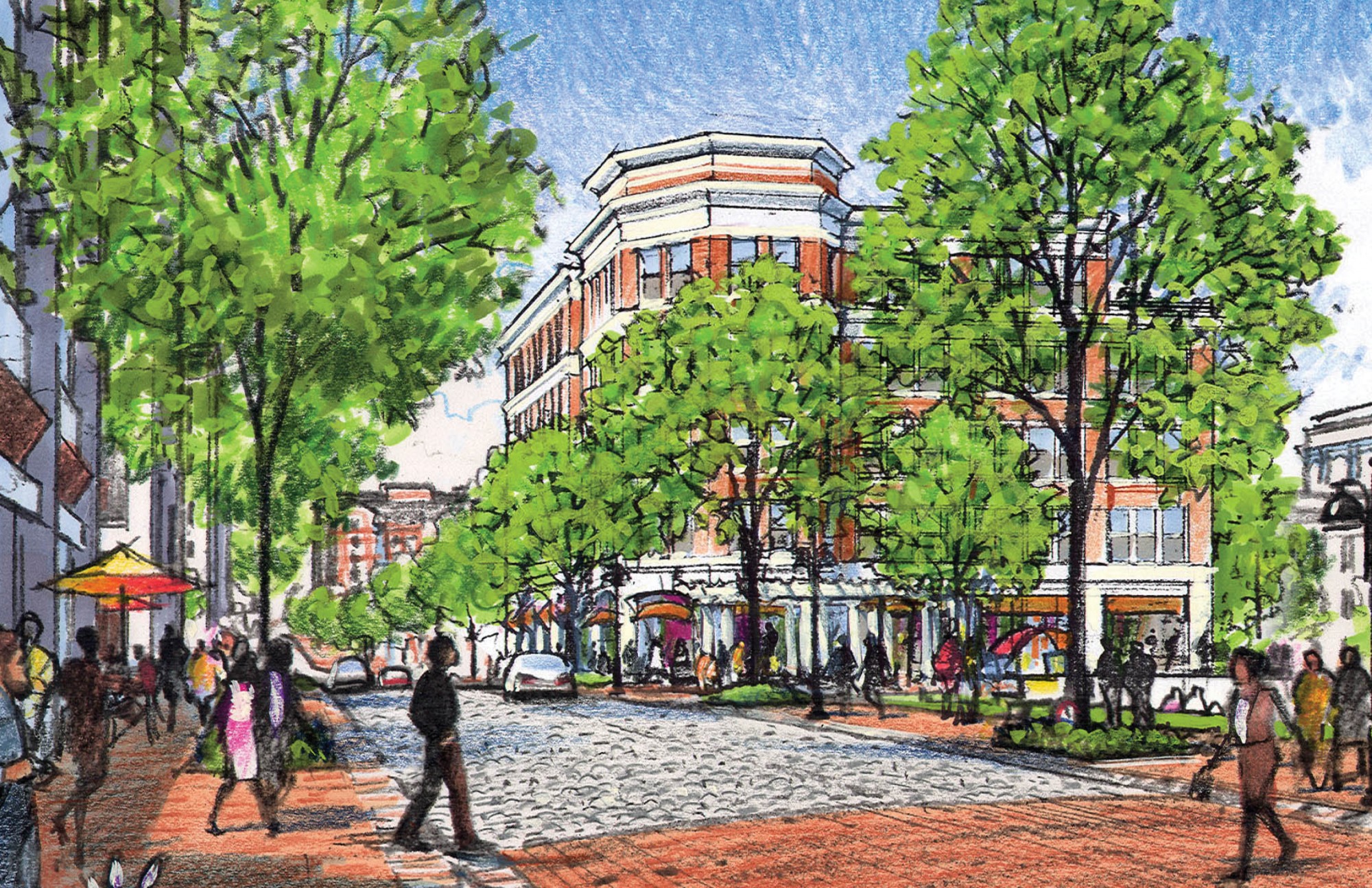
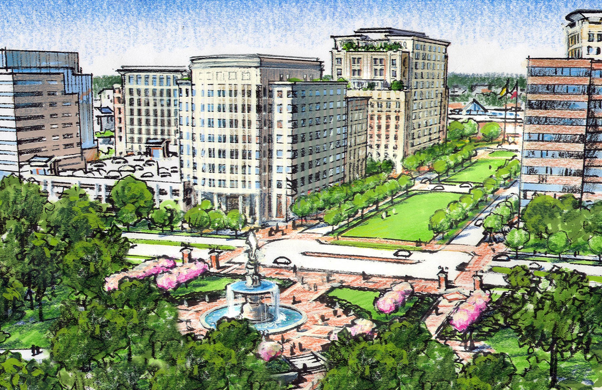
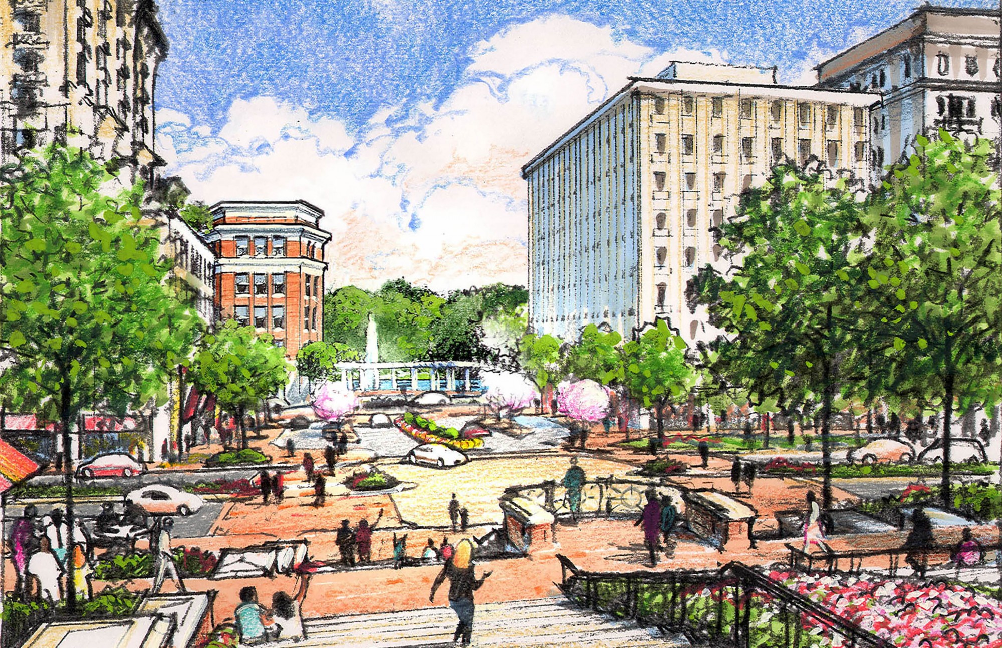
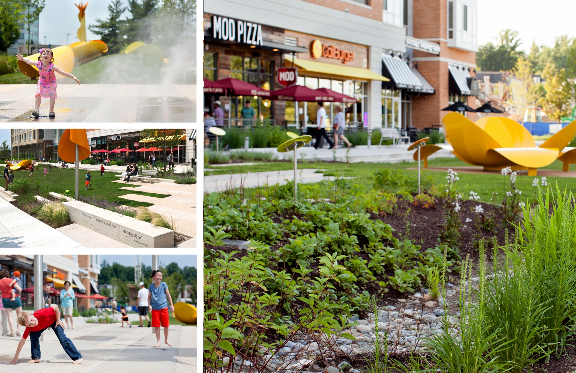
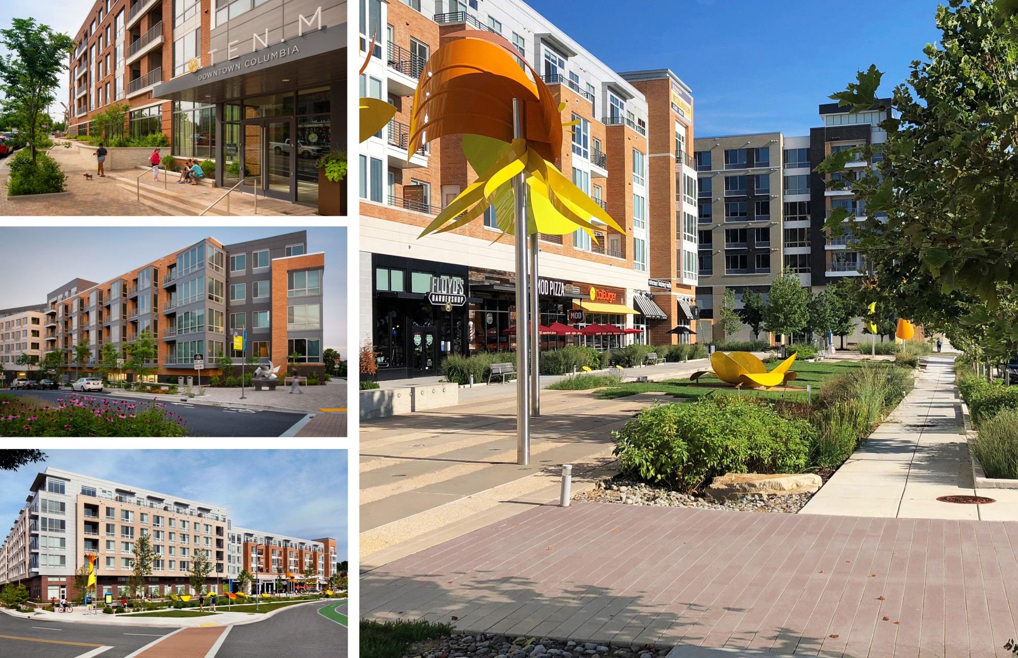
The master plan establishes four distinct neighborhoods with appropriate and varying densities, building heights, and block and street patterns, informed by the context of surrounding neighborhoods to ensure compatibility, including Warfield, Symphony Overlook, Merriweather, and Lakefront. Governor Warfield Parkway and Little Patuxent Parkway are reimagined as more walkable corridors with frequent intersections, shorter block lengths, bike lanes, and reduced travel lanes. The Plan guides redevelopment with an entirely new pattern of walkable streets and blocks; the extension of nearby neighborhood streets to better link nearby neighborhoods to the Downtown; requirements for new greens, squares, and plazas; enhanced environmental and natural areas; a percent for art program; and a phased implementation strategy that guides public and private investments. The plan, too, calls for the creation of an Affordable Housing Commission, an Arts and Cultural Commission, and a Downtown Partnership (all of which have been formulated), to ensure civic, arts, event, and cultural considerations support the Downtown vision. Design guidelines establish regulations for urban, architectural, street and streetscape, and public open space design. To date, more than $500M of combined public and private infrastructure and development investment has begun the transformation.
Following adoption of the Downtown Columbia Plan in 2010, The Howard Hughes Corporation engaged Design Collective to prepare small area plans and design guidelines for the Warfield District 2013, the Merriweather District 2015, and the Lakefront District 2019.These small area plans (neighborhood plans) include reconciliation of the appropriate mix of uses, densities/FAR, and building types (as governed by the Downtown Plan), a full traffic analysis, market demand and economic impacts and benefits analyses, public input sessions, and full Planning Commission presentations prior to final adoption. The plans and design guidelines have guided the implementation of several new streets and blocks, over 2M SF of mixed-use buildings (residential, office, and hotel), and new parks, squares and open spaces. Each district includes initial phases of innovative green infrastructure, enhanced environmental features (wetland mitigation and stream restoration, for example), on-street bicycle lanes, shared use paths, and public art. A new fine and performing arts center with upper floors of affordable housing will begin construction in 2022, addressing the community’s desire to support civic, arts, and public needs.